Support / The map & imagery / Aerial photo
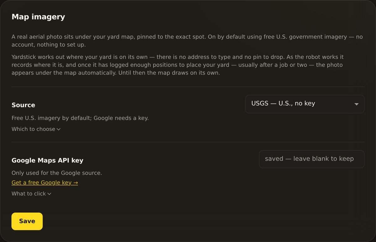
Yardstick lays a real satellite photo of your property under the coverage map, pinned to the exact spot. Most people never touch this. It works out of the box, with no account and nothing to set up.
There is no address to type and no pin to drop. As the robot works, it records where it is. Once Yardstick has logged enough fixed positions to know where your yard sits on the earth, it fetches the matching aerial photo and slides it under the map. It downloads once and keeps a copy, so it is not pulling imagery every time you open the page.
The robot logs fixed RTK positions as it works.
Enough positions pin your property on the map.
The aerial image is fetched once and cached under the map.
Two reasons, and only two:
If neither applies, stay on USGS. A Google key is free for this use but does require a Google Cloud account with billing set up, which is more work than most people need.
The one detail that trips everyone up: Google has many map products, and Yardstick uses exactly one of them, the Maps Static API. If that specific API is not switched on, the key will not work no matter how it is set up.
In the Map imagery panel, click Get a free Google key →. It opens Google's setup, which walks you through creating a project and a key.
This is the step people miss. In the Google Cloud console, find APIs & Services → Library, search for Maps Static API, and click Enable. Not the JavaScript API, not any other maps product. The Static API is the one that returns a single photo.
Google requires a billing account on the project even though this usage is well inside their free tier. Without billing enabled, the key returns an error instead of a photo.
The key starts with AIza. Paste it into the Google Maps API key field, set Source to Google, and press Save. Reopen your map and the sharper photo should appear.
Yardstick never leaves you with a blank map. If a Google key returns no image, it quietly falls back to the free USGS view and tells you why:
So if you set a Google key and still see the USGS photo, the key is being rejected. Work down this list, it is almost always the first one:
This is the most common one by far. It means the Maps Static API is not enabled on your project. Go to APIs & Services → Library, search Maps Static API, and click Enable. Enabling a different maps API will not fix it, it has to be the Static one.
Google requires a billing account on the project. Add one in the Cloud console under Billing. This usage sits inside Google's free allowance, but the account still has to exist.
Almost always an HTTP-referrer restriction on the key. Yardstick requests the image from your computer, so there is no web page referrer to match. Remove the referrer restriction, or switch it to an API restriction that allows the Maps Static API.
Check that Source is set to Google (not USGS) and that you pressed Save. Then reopen the map. Also confirm the key starts with AIza and has no stray spaces.
Yardstick has not placed your yard yet. It needs enough fixed RTK positions to know where you are, usually after a job or two. Let the robot record a run and check again. Until then the map draws on its own with no photo underneath, which is normal.
Still not seeing the photo you expect? Open a support ticket and tell us which source you chose and what the panel says. Because Yardstick runs on your own machine, we can usually point you to the exact setting.