First, the trap
Google now hands out a free key with no credit card, called a Maps Demo Key. It is genuinely free and it genuinely will not work with Yardstick. This catches almost everyone, so it is worth understanding before you start rather than after.
Yardstick asks Google for a finished picture of your yard, which is the Maps Static API. The demo key does not cover that one. Google's own page lists what the demo key supports, and then says: "To use any API or feature not listed below, you need to either add a billing account to your Maps Demo Key or create a new API key and enable billing."
If you paste a demo key into Yardstick, the map quietly keeps showing the USGS photo. Yardstick will tell you the key returned no imagery, but Google's reason for refusing it is the part that matters, and the fix is always the same: attach a billing account.
The walkthrough
Get a key
Go to Google Maps Platform and start a demo key. No card is needed at this point. This is a fine place to begin even though the key will not work yet.
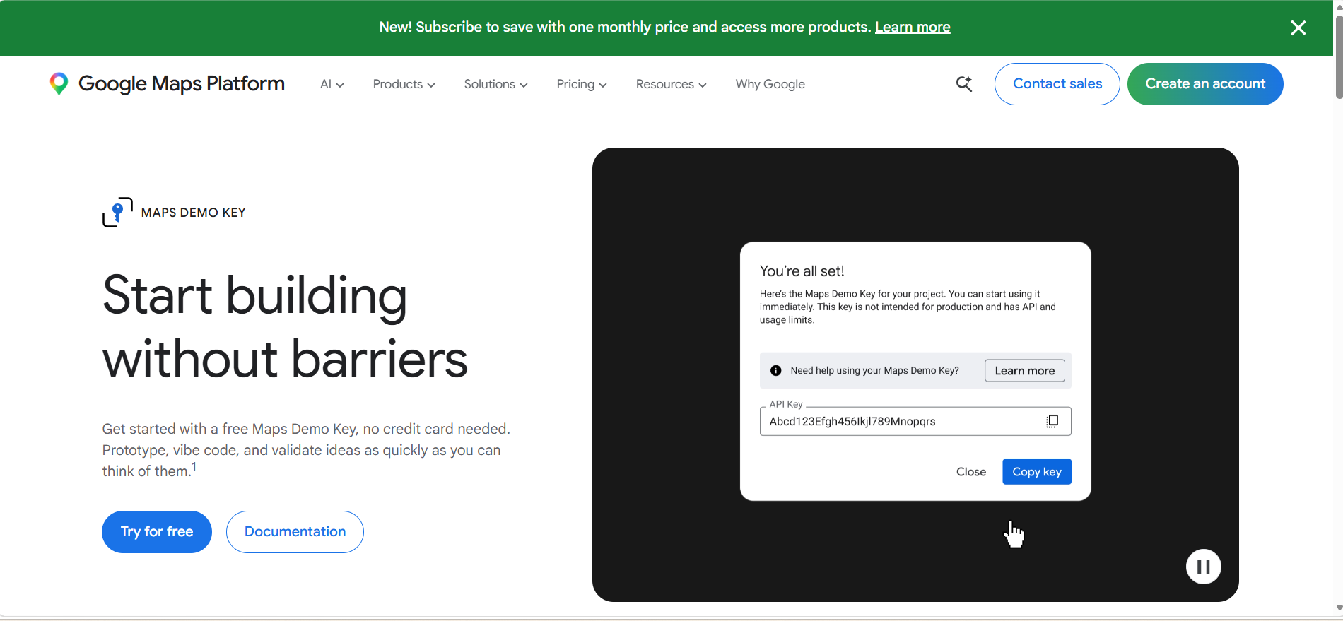
Read the small print, then press Upgrade account
Google gives you the key and says, in the same breath, that it is limited to testing use. That sentence is the reason it will not draw your yard. The Upgrade account link beside it is the fix.
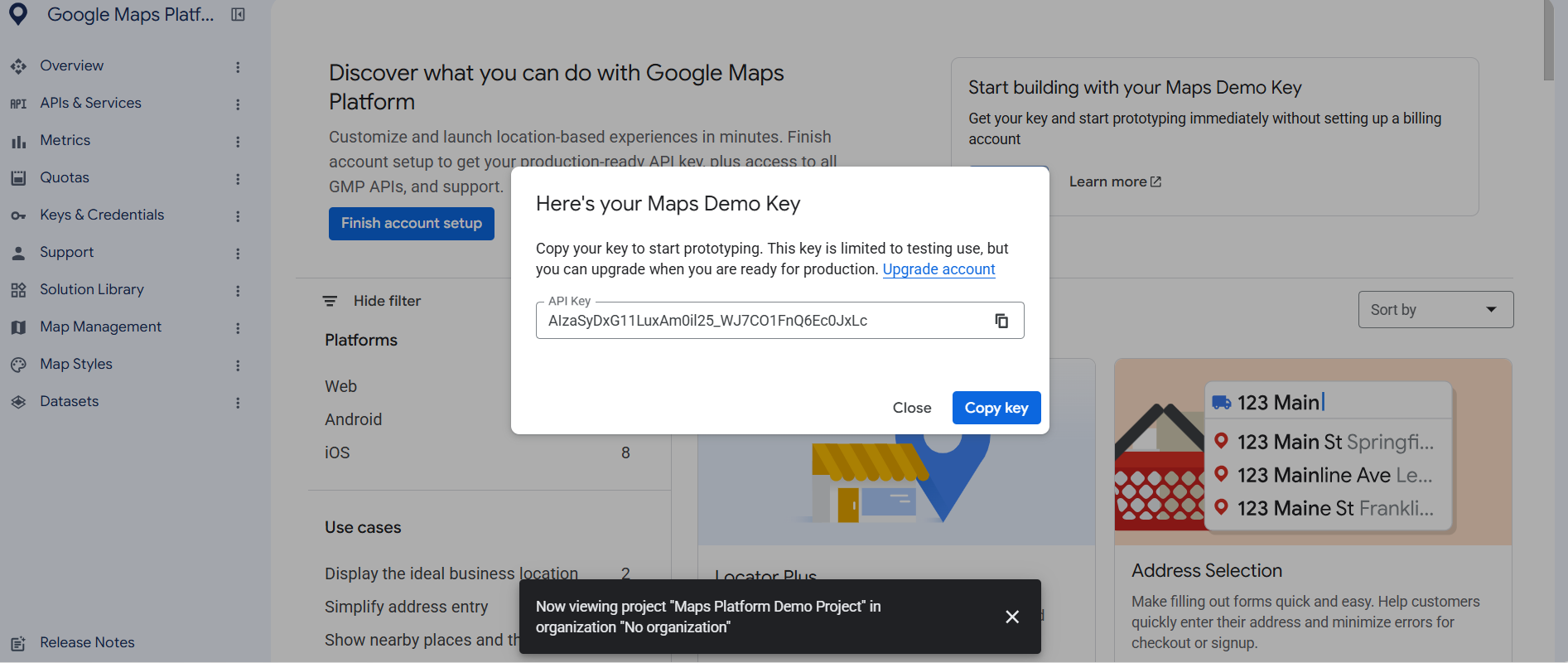
Upgrade
Google explains what changes: all of its Maps APIs become available to your project, your existing key keeps working, and you get up to 10,000 free calls per product per month. That free allowance is the important number and we come back to it below.
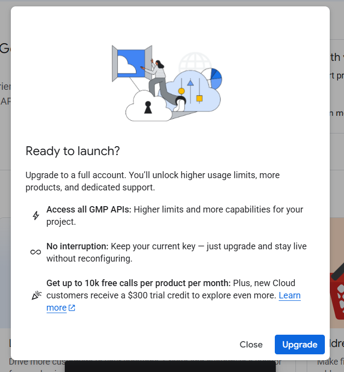
Attach a billing account
If you already have one, pick it. If you do not, Google walks you through creating one, and it asks for a card. There is no way around this: Google requires billing on any project that uses the imagery Yardstick needs. What it will actually cost you is the next section, and the answer is nothing.
Let it enable the APIs for you
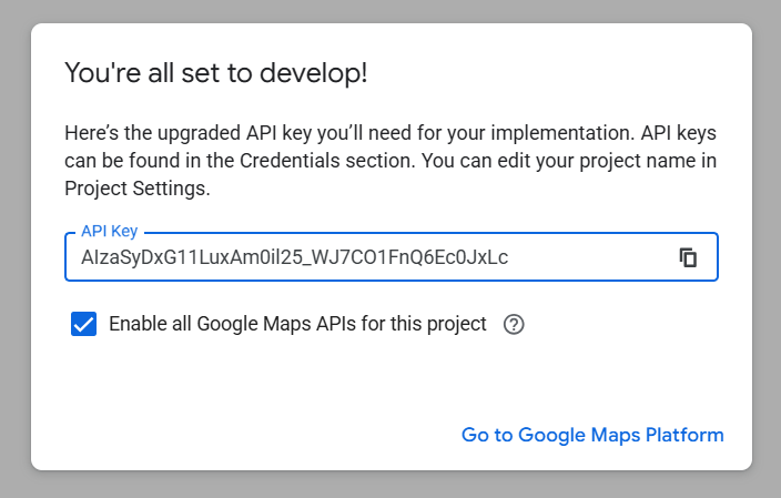
When the upgrade finishes, Google shows your key again with Enable all Google Maps APIs for this project already ticked. Leave it ticked. That is what switches on the Maps Static API, and it saves you hunting through the console for it.
Paste it into Yardstick
Open Settings, find Map & aerial photo, set the source to Google, paste the key, and press Save. Then reload the map page.
You will need a billing account
Google requires one. Their own documentation for the imagery Yardstick uses says it plainly: "To use the Maps Static API, you must enable billing on each of your projects and include an API key or OAuth token with all API or SDK requests."
There is no way around it, and the free demo key is not a way around it either. If you do not already have a billing account, the Upgrade step above creates one, and it asks for a card.
What it will cost you: nothing
Google includes 10,000 free map images every month. Yardstick uses about sixteen.
That is measured, not guessed. On the developer's own machine, recording a real property all season, Yardstick fetched 20 aerial images in 37 days. It is that low because of how the feature works: one image per map view, kept for 90 days, and fetched again only when your yard's recorded boundary changes or the stored copy ages out. Panning, zooming and reloading the map cost nothing, because the picture is already on your computer.
To reach 10,000 in a month you would have to pull a fresh image every four and a half minutes, day and night, all month. Nothing in Yardstick does that.
If you somehow went over anyway
At the time of writing, September 2026, Google charges $2.00 per 1,000 images above the free 10,000, for anything up to 100,000 a month. The first image you actually paid for would cost you a fifth of a cent.
Those are Google's prices and Google changes them. The current rate is always on their pricing page.
If the map still shows USGS
Restart Yardstick first
On version 1.0.5 and earlier a saved key is not used until Yardstick restarts. This is the single most common cause and it costs you nothing to rule out.
Check it is a key on a billing account
A demo key will never work. If you have not been through the Upgrade step, that is the answer.
Give it a few minutes
Google can take several minutes to start serving a newly enabled API. We have watched the same key refuse a request and then serve it perfectly twenty minutes later, with nothing changed in between.
Check the key has no website restriction
Yardstick asks Google from your own computer, not from a web page. A key restricted to HTTP referrers will always be refused.
Still stuck? Send us the log
In Settings, press Send diagnostics to Yardstick. One click. It tells us which source was asked for, which one answered and whether a key is saved. Your key is never included.